
Kentucky Speleological Survey Trip Report
Cave Name: Campbell Cave (Bluegrass Cavern)
Location: Christian County
Date: 5-31-2020
Report Author: Josh Brewer - NSS 56030 & Clint Barber
To Date Survey Total: 5,452.49’
Trip Total: 589.98’
Last Survey Station: ZA6
Other Notes:
Attended by: Barry Adams NSS 64255, Josh Brewer NSS 56030, Nick Lashley & Clint Barber made up the survey team. Also joined by Joel Dempsey, Ben North & Jackson Benningfield
Photos credits : Chuck Sutherland and Christopher Morris
Report:
At 9:30, after a few morning delays, the survey team of Barry Adams, Clint Barber, Josh Brewer & Nick Lashley met the owner Joe Dempsey, his son Joel & his two friends Ben North & Jackson Benningfield at the entrance. Joel had visited the cave before, but never explored past the first thousand feet. We invited the three young men to join us as we headed to the far upstream section of main passage that remained unsurveyed.
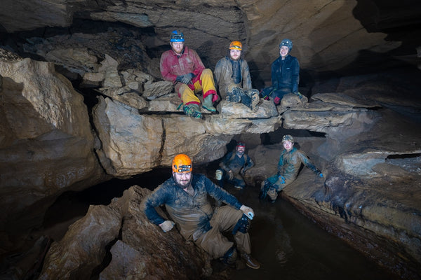
Photo by: Christopher Morris
The trip would take about an hour and a half to reach the beginning of the survey. Campbell’s main passage begins 15 feet wide and tall. As you go further in the cave, its ceiling starts to come down on you. The group made it to D-Survey pretty fast. Everyone was laughing & joking, but then the stoop-walking & hands and knees crawling in the stream began. Everyone made some-sort of noise when the water penetrated into warm, dry zones. Soon after we got in the water, the first duck-under was upon us. The survey team was prepared with wetsuits (well, not Barry, he's our cave walrus) but our tag-along friends weren’t so lucky. From this point on, I found myself grinning ear-to-ear listening to the three of them talk about the obstacles we were negotiating, to continue forward, to turn back, and overall how crazy fun this exploring was. I was very proud of all them. They pushed all the way to the beginning of survey & where the first explorers had ended in the 1960s. As we prepared for survey, we talked to the guys about the trip out. They felt comfortable and after a few moments they were off.
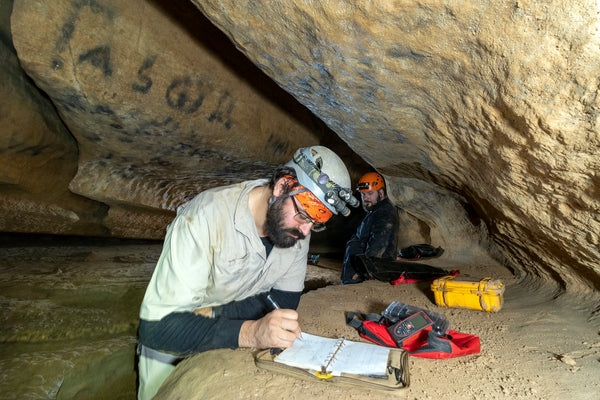 Photo by: Chuck Sutherland
Later, Joe told me that Joel, Ben & Jackson had a great adventure.
We split into teams. Push team was Nick & Clint. Mop up was Barry & Josh. I had decided that a leap frog survey would be the best way to give the upstream a real survey push. I told Nick to place a station where he thought I’d be ready to turn around, and Barry and I would survey to that. We began surveying and immediately had a lead off the left wall. I took a few shots down it & made my way back towards Barry. Things were getting low, passage was 2 feet tall and dropping. I slide past Barry grabbing the DistoX (digital measuring device / cave surveying tool) and shot four more shots to tie to Nick. I yelled good luck and turned back.
Barry & I packed up & headed towards A39 lead. This lead never looked that great. Every time I’ve been there I tried to find someone to push or map it. Barry & Caralynn pushed it a bit. Weston pushed it... but here I was mopping up and this lead was in front of me.
The area is dominated by breakdown from a presumable sinkhole above. The stream flows out from under a ledge and that’s where I started. I shot a few shots and passage pinched down to under a foot, but I could see bigger passage ahead. I checked and poked around the breakdown and ended up digging out some mud for 20 minutes. I yelled to Barry that I was through! The dig lead to 50 feet or so of passage that looped back over to the stream. One odd thing; I saw a baseball hat & jacket laying behind some breakdown. I didn’t touch it. I crawled back out and joined Barry.
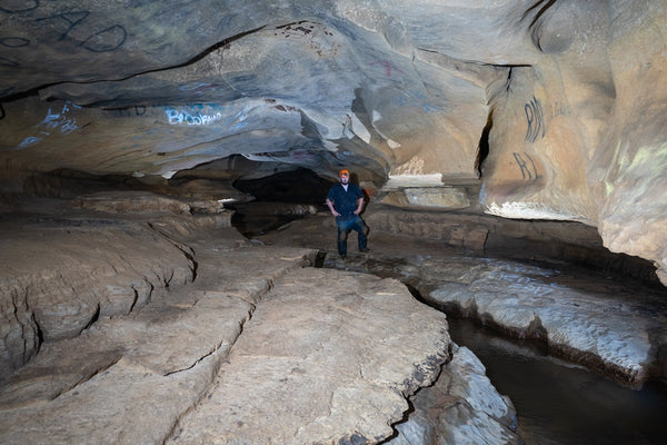 Photo by: Christopher Morris
We headed out of the cave, a trip Barry & I have done two other surveys. We still hadn’t seen Nick & Clint, so we decided to take it nice and slow out of the cave. We looked at crickets and crayfish. Stopped at a few signatures. Same old stuff. But this time there was something new... A MISSED SIDE LEAD!
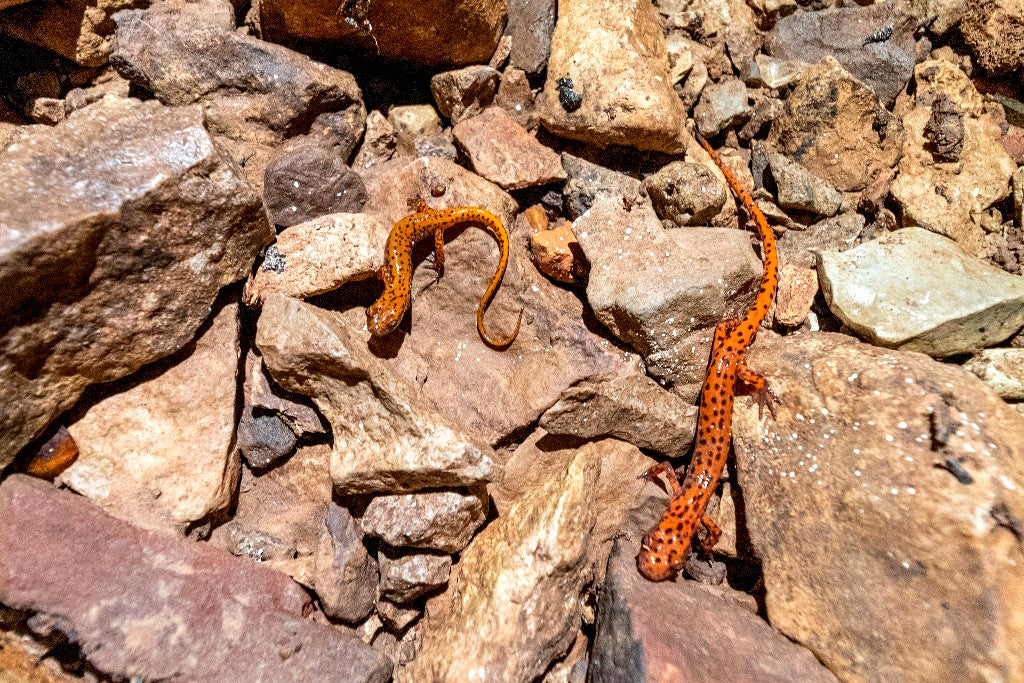
Photo by: Chuck Sutherland
Barry was swimming down a part of the stream that the normal trail was up out of the water on a ledge, from there it just looked like cave wall... but Barry found a new passage that was blocked out of view by a ceiling ledge. The most amazing thing is that we all missed it! It’s within 800 feet of the entrance. Totally blew my mind. I poked my head in, saw 20 feet & formations 2 feet tall & wide.
Push Team Report: By Clint Barber
Nick Lashley and myself (Clint Barber) started our survey around 11 am at the far upstream water crawl in Campbell where the average ceiling height started to be about 2' high. The goal was to reach a combined 480' of survey between both teams.
Our first two shots netted us 100' of survey very quickly but that abruptly changed when our next shot took us through a keyhole slot into a large breakdown room. I managed to slip through the keyhole which consisted of a flat slab of rock that had peeled off the ceiling and was resting on a ledge at an angle that kept one side about 1.5' off the floor and the ceiling being several more of the same large flat pieces of cracked and hanging rock. It was very tedious and nerve-racking going through trying not to dislodge anything. Nick could not fit through the keyhole and thoughts of solo survey quickly entered my mind - I was not particularly happy. I mentioned that it might be possible for him to lay in the stream and crawl in from underneath. Nick backed out and managed to squeeze his way through from underneath. To the left we took the survey through some breakdown and into a confluence of three small, dry, dandy incoming passages. There we encountered what appeared to be racoon scat but there was no airflow and the passages didn't seem worth pushing past what we could shoot into them with the Disto.
We continued survey back in main passage over a huge piece of breakdown and up and to the right into a small circular dome room with a flat ceiling about 10' across. Our next shot took us down into the stream again where the stream was emerging from a 1'h x2'w tube with about 2"-3" of water. This crawl had been pushed on a previous trip when the water was a little higher for about 40'.
At this point we knew we were close to the goal of 480' of combined survey, but we couldn't be sure we had gotten it because we had no idea of what success the other team had made. I was determined not to go down this tube because I was already cold, hungry, and ready to exit, but Nick was determined to get one more shot. He crawled down the grim passage, and we managed to get one more shot of a whopping *not sure of the footage*. There was airflow present coming from the lead but satisfied with the footage and the difficulty of moving forward we decided to call the survey. I left a high and dry station Z7 on the ledge 90° above the center of the stream for any soul who is bold enough to try and push the cave further.
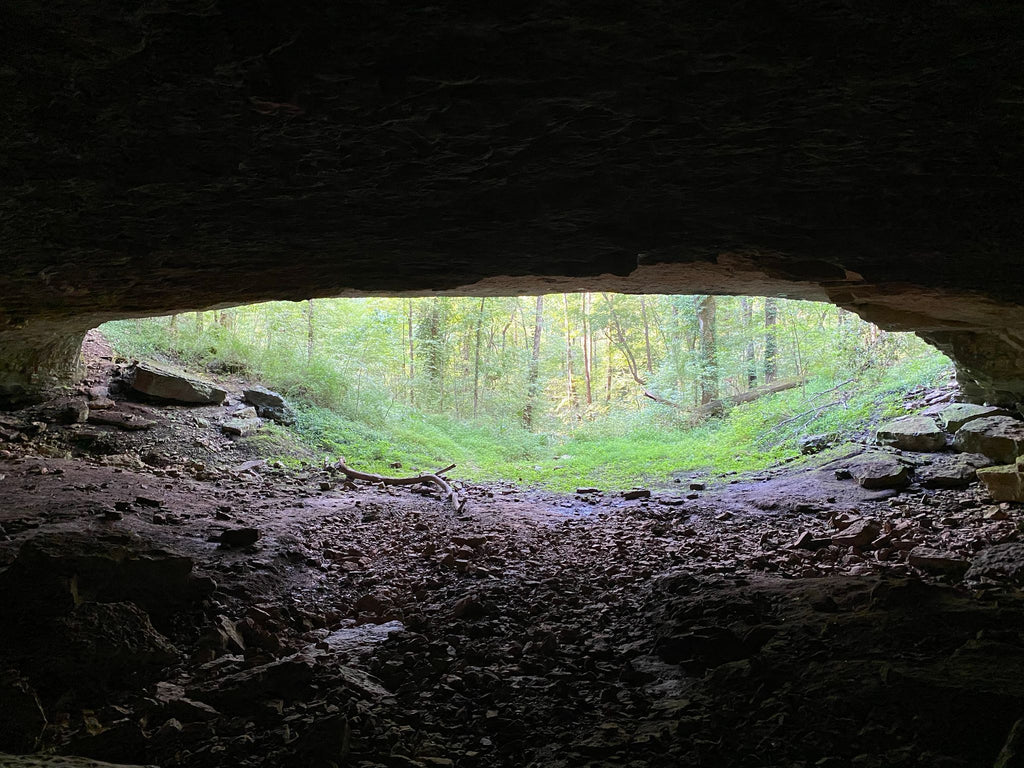 Photo by: Flightdubs, LLC
About the Author
Josh Brewer
Cave Research Foundation Fellow
Cave Surveyor & Cartographer
National Speleological Society Lifetime Member
Kentucky Speleological SURVEY - Western Kentucky Regional Coordinator
More than fifty miles of cave exploration and survey experience


 Photo by: Chuck Sutherland
 Photo by: Christopher Morris
 Photo by: Flightdubs, LLC